What MapPilot does
- Maps — ten online map styles from OpenStreetMap and other public tile providers, with the provider credit shown on every map.
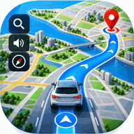
- Driving routes — distance and estimated arrival time for a car or a motorcycle, calculated by the public OSRM router, with turn-by-turn guidance and optional voice prompts.
- Route planning — multiple stops, drag to reorder, and an option to let the router choose the stop order.
- Weather and air quality — current conditions, an hourly and a seven-day forecast, and a US AQI reading, from Open-Meteo.
- Offline maps — download a map region in the background and view the map without a network connection.
- GPS tools — compass, speedometer, area calculator, world clock, country information, find address, satellite view, saved places, trip history and an on-device translator that runs without sending your text to a server.
What it does not do
MapPilot is built entirely on free, public services, and it is honest about their limits:
- Routing is for cars and motorcycles only. There is no walking or cycling routing, and no option to avoid tolls, highways or ferries — the free router does not support them.
- There is no live traffic data inside the app. Live traffic, Street View and nearby-place category searches open the Google Maps app or website when you tap them.
- Maps, routes, weather and arrival times come from third-party services and can be incomplete, outdated or wrong. They are information, not instructions — always follow road signs and traffic law.
- Offline regions are snapshots taken when you download them. Only the map itself works offline; search, routing and weather need a connection.
Privacy in short
MapPilot has no accounts and no sign-in, and its developer runs no server, so nothing you type or save in the app is ever sent to us. Saved places, routes, trip history and downloaded maps stay on your device, and Settings → Delete all my data removes them.
The app is free and supported by advertising through Google AdMob, and includes Google Firebase Analytics to count which features are used — never your location, your searches or anything you type. Where the law requires it you are asked for consent first, and you can change that choice, or switch usage analytics off, in the app’s Settings.
To show maps, search places, plan routes and fetch weather, the app contacts free third-party services such as OpenStreetMap, Nominatim, OSRM and Open-Meteo. The Privacy Policy lists every one of them and what it receives.
Availability
MapPilot is being prepared for release on Google Play and is not published yet. This site currently exists to host the app’s Privacy Policy and Terms & Conditions. A link to the Play listing will be added here once the app is live.
Contact
Questions about the app, this site, the Privacy Policy or the Terms: tracemobilecallerlocation@gmail.com